| Major Flood of March 31, 2003 Nova Scotia and New Brunswick, Canada |
Meteorological Imagery
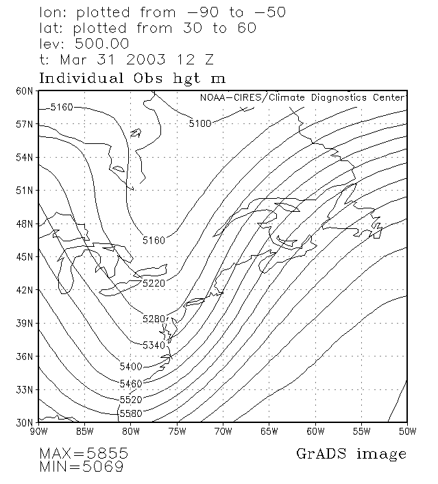
500-mb Height Analysis, 12UTC 31 March
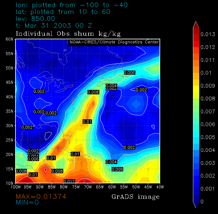
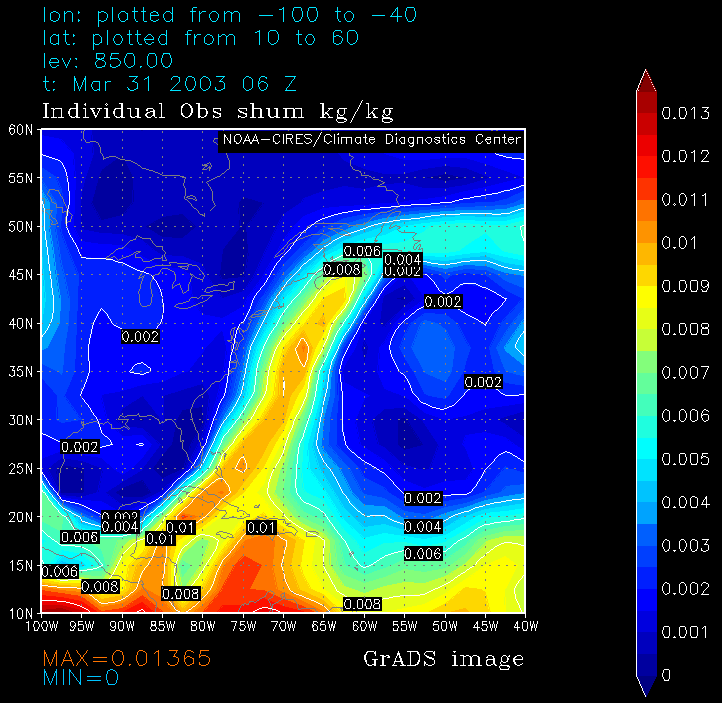
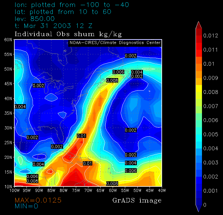
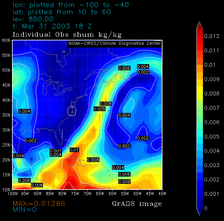
850-mb Specific Humidity:
00 06 12 18 UTC 31 March
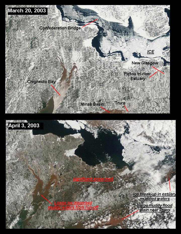
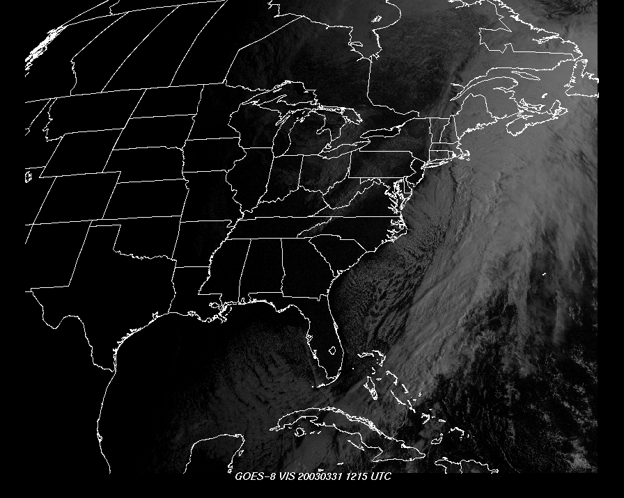
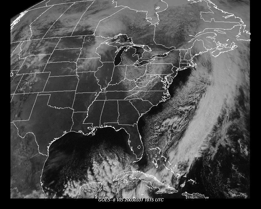
High Resolution before-and-after satellite
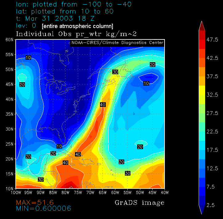
Precipitable Water 18 UTC 31 March
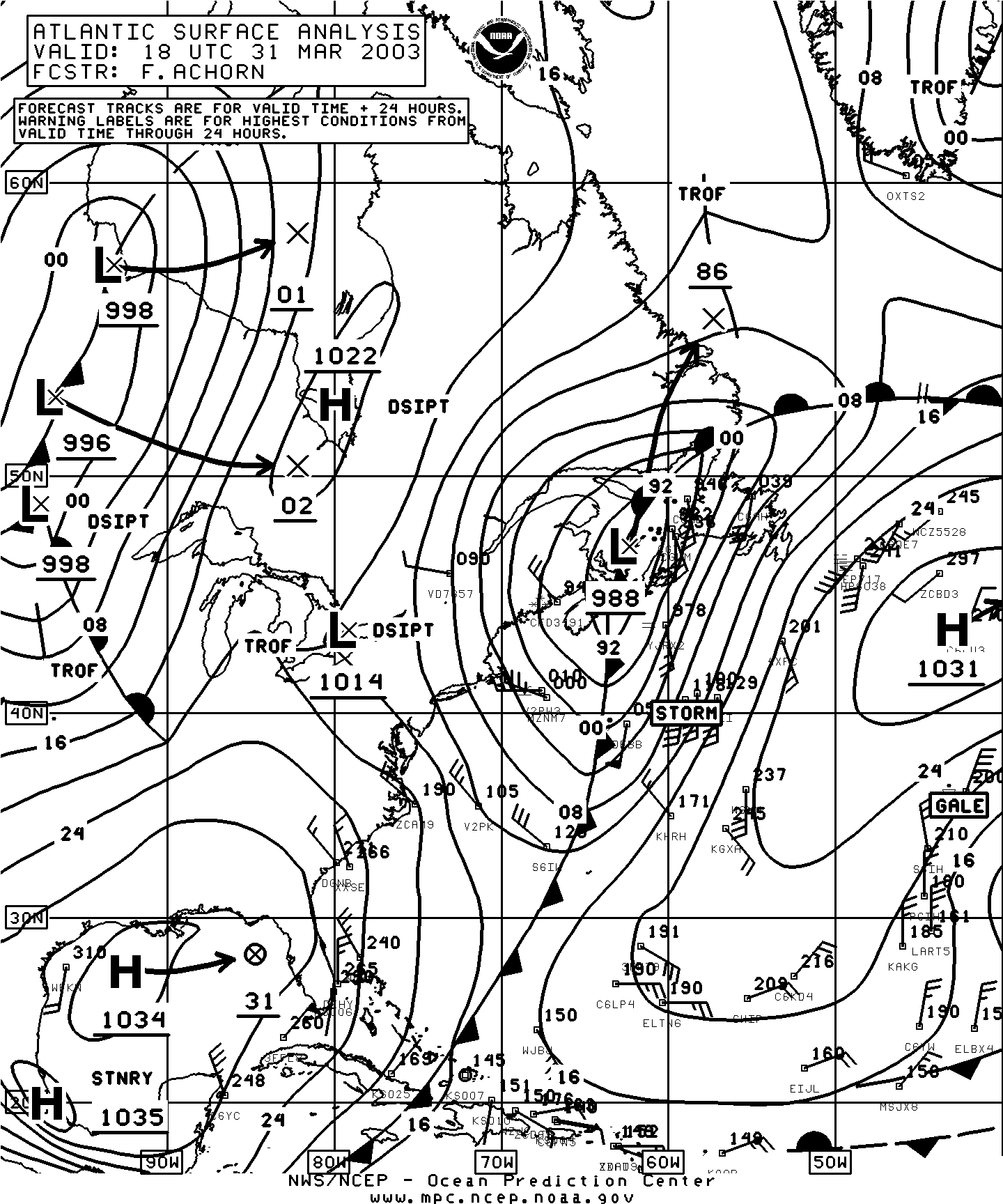
Surface Analysis (MPC) 18 UTC 31 March
Visible Satellite Imagery 12 18 UTC 31 March
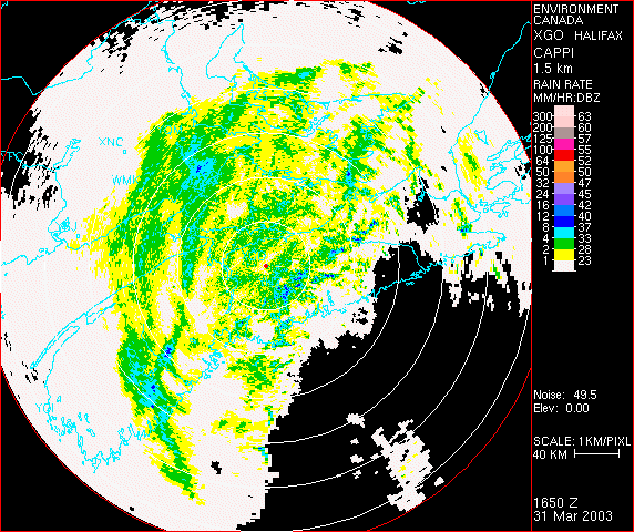
Radar Loop (near the end of the heaviest rainfall, note
narrow band of very heavy rains on leading edge)
500-mb Height Analysis, 12UTC 31 March
850-mb Specific Humidity:
00 06 12 18 UTC 31 March
High Resolution before-and-after satellite
Precipitable Water 18 UTC 31 March
Surface Analysis (MPC) 18 UTC 31 March
Visible Satellite Imagery 12 18 UTC 31 March
Radar Loop (near the end of the heaviest rainfall, note
narrow band of very heavy rains on leading edge)
Storm summaries and rainfall totals
Weather office storm summaries (WOCN)
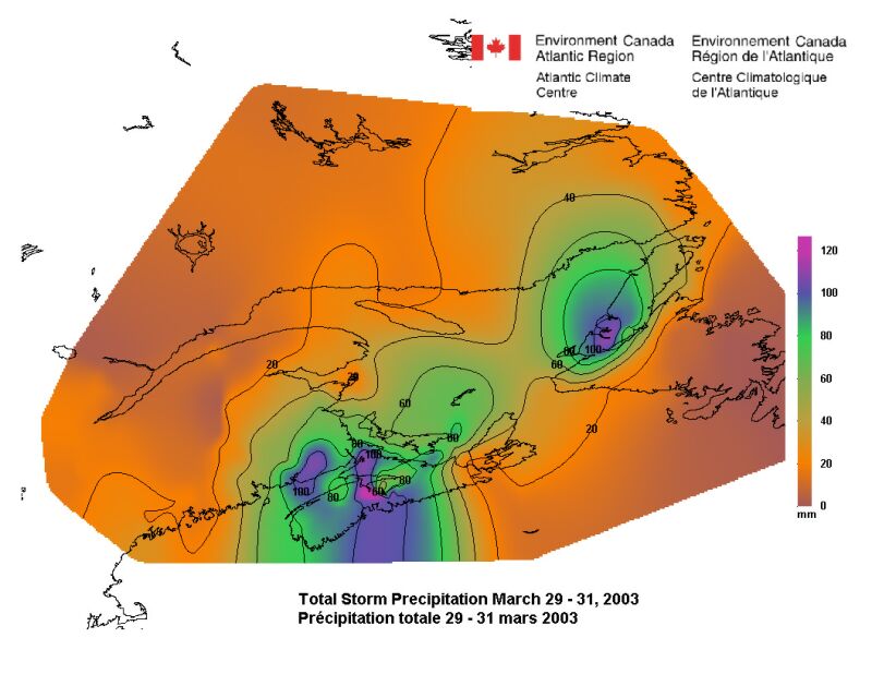
Total precipitation map (prepared by Bill Richards)
Regional Summary (with data table)
River Flood-level Data (Sackville and LaHave Rivers, NS)
Weather office storm summaries (WOCN)
Total precipitation map (prepared by Bill Richards)
Regional Summary (with data table)
River Flood-level Data (Sackville and LaHave Rivers, NS)
Photographs
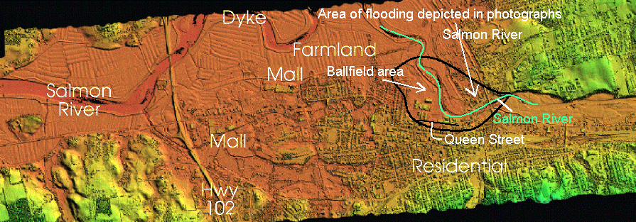
Relief map of Truro flooding area
(Lowest elevation is brown in color)
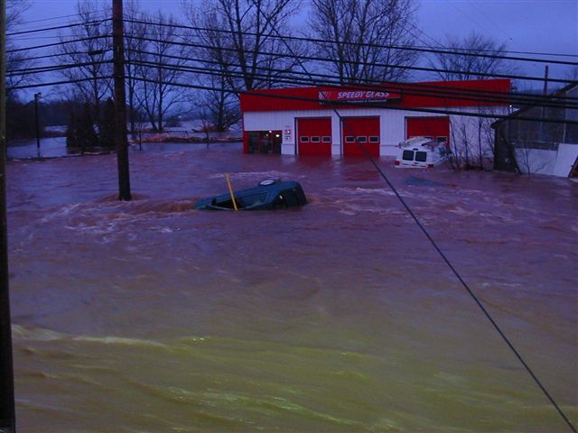
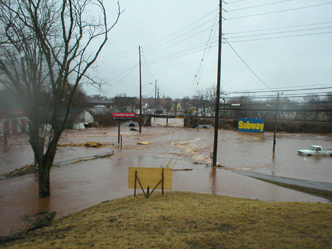
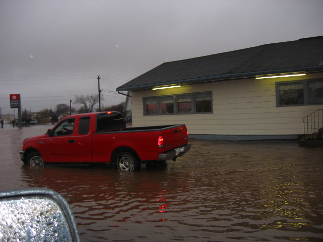
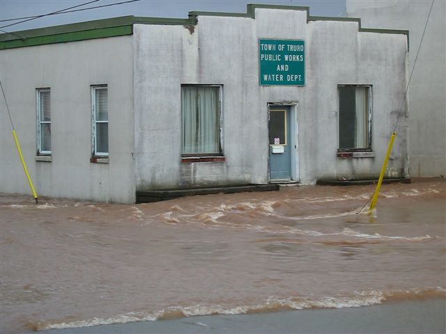
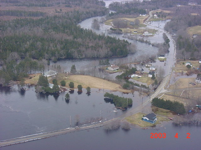
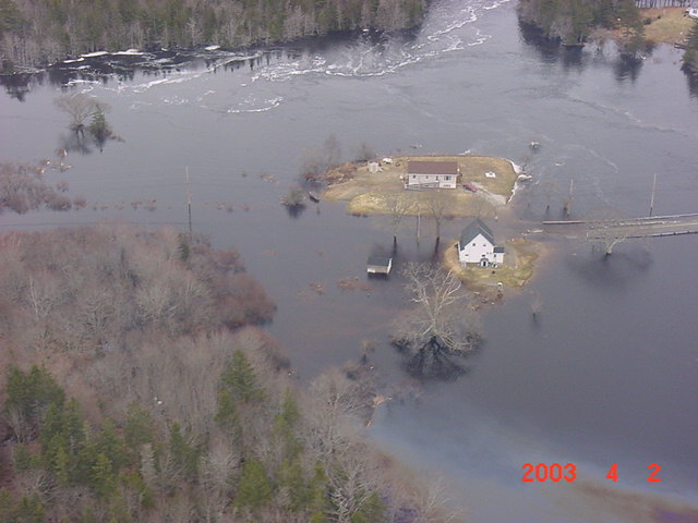
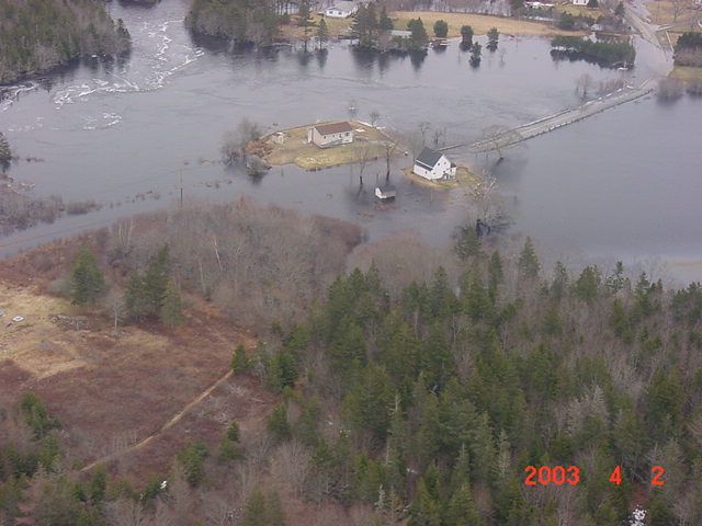
Flooding in Truro (courtesy of Claude Barbeau)
1 2 3 4 5 6 7 8 9
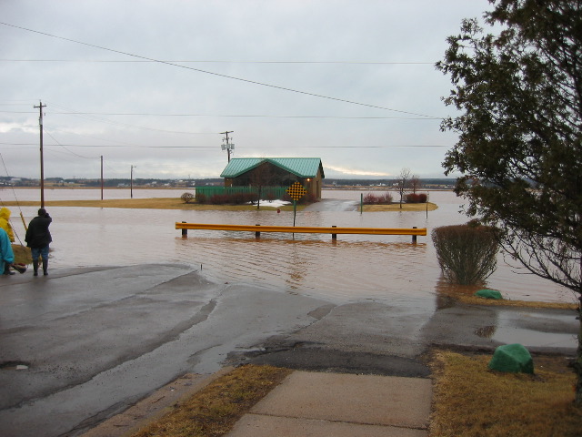
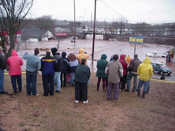
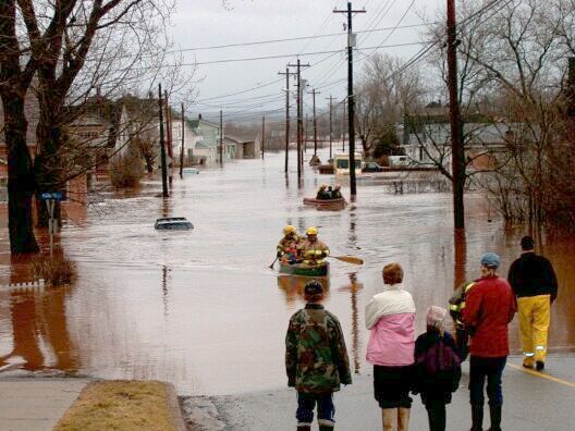
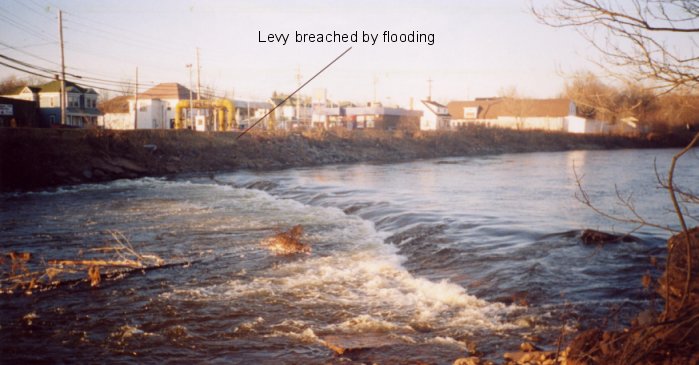
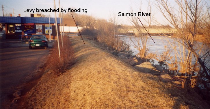
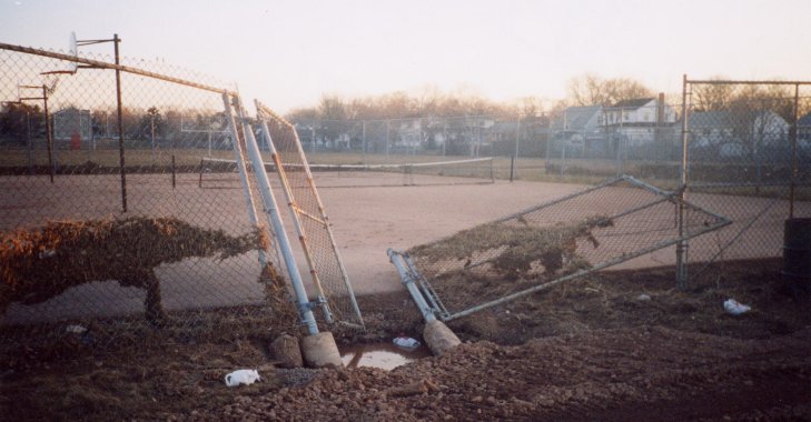
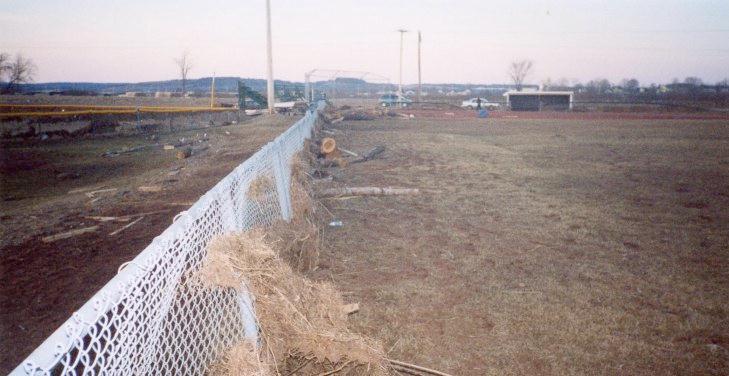
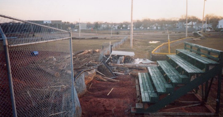
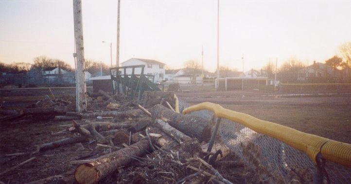
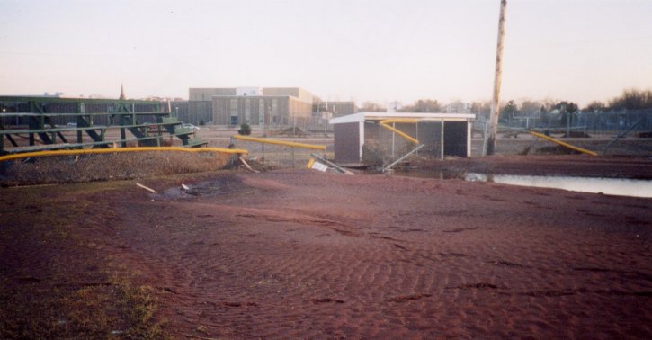
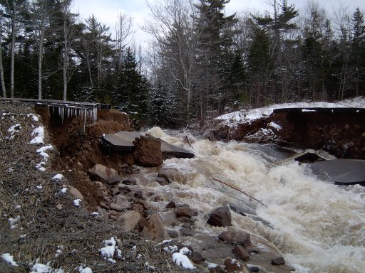
Damage in Truro (Images by Chris Fogarty taken April 4/03
including flood level of Salmon River)
1 2 3 4 5 6 7 8 9 10 11
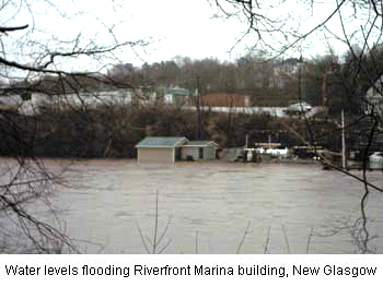
New Glasgow Riverfront
Pictou County Images (Andrew Spicer)
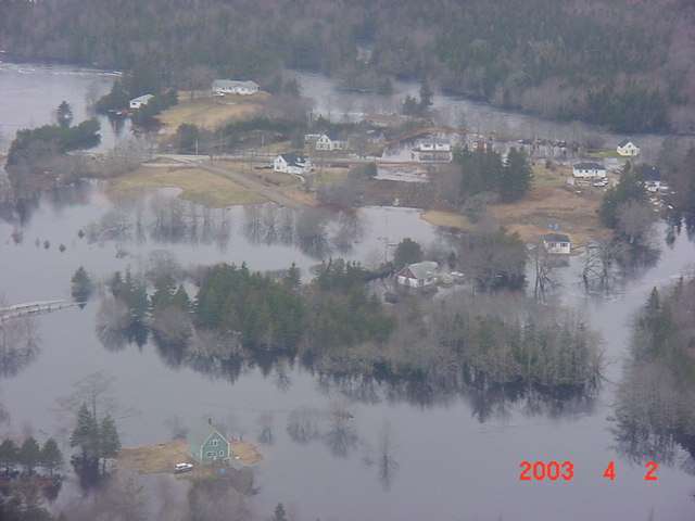
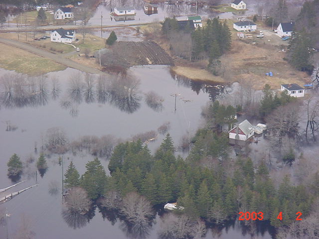
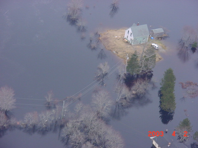
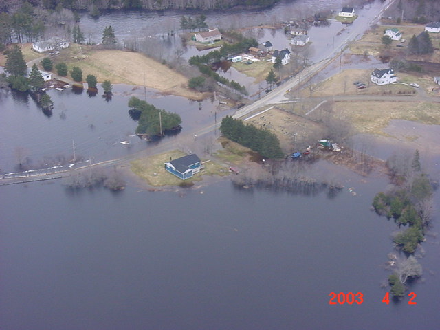
Quinan (near Yarmouth) April 2 (courtesy of
Marc Fournier) 1 2 3 4 5 6 7
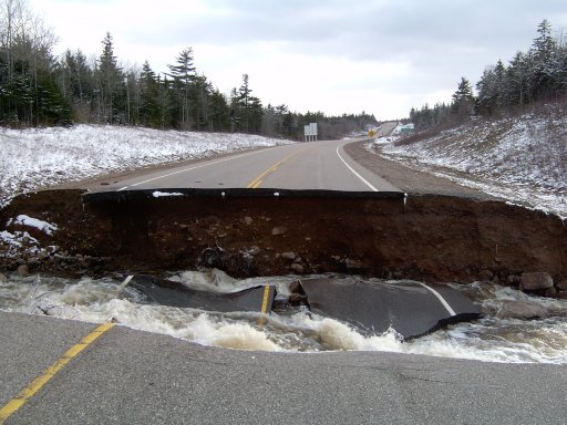
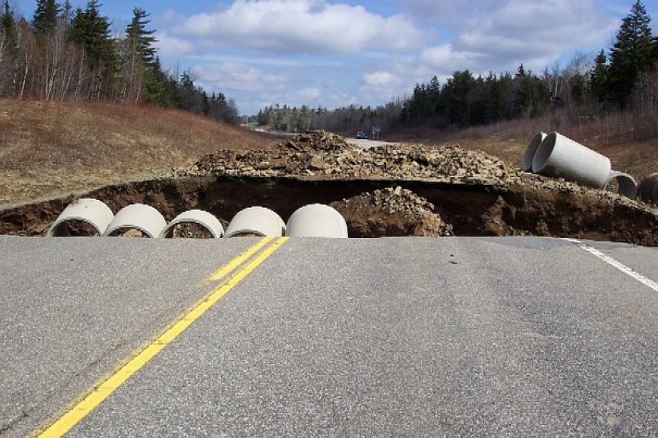
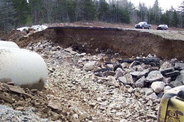
Highway 101 washout (Annapolis County April 1)
(courtesy of Paul Richard, NSDoT) 1 2 3 4
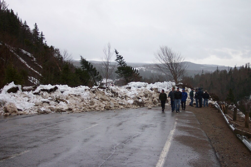
Rain-induced mud/snowslide in Newfoundland
Relief map of Truro flooding area
(Lowest elevation is brown in color)
Flooding in Truro (courtesy of Claude Barbeau)
1 2 3 4 5 6 7 8 9
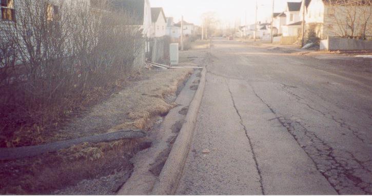
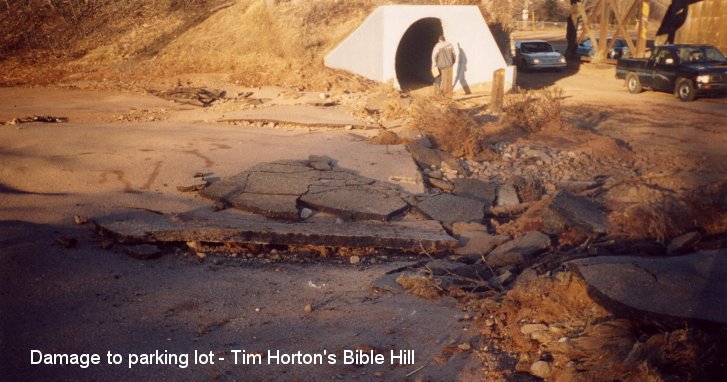
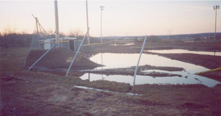
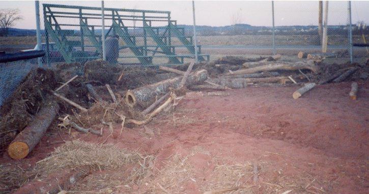
Damage in Truro (Images by Chris Fogarty taken April 4/03
including flood level of Salmon River)
1 2 3 4 5 6 7 8 9 10 11
New Glasgow Riverfront
Pictou County Images (Andrew Spicer)
Quinan (near Yarmouth) April 2 (courtesy of
Marc Fournier) 1 2 3 4 5 6 7
Highway 101 washout (Annapolis County April 1)
(courtesy of Paul Richard, NSDoT) 1 2 3 4
Rain-induced mud/snowslide in Newfoundland
Meteorological Observations
METARS and SAs of hardest hit areas:
Amherst Truro Caribou Pt. Saint John
Halifax Int'l Shearwater
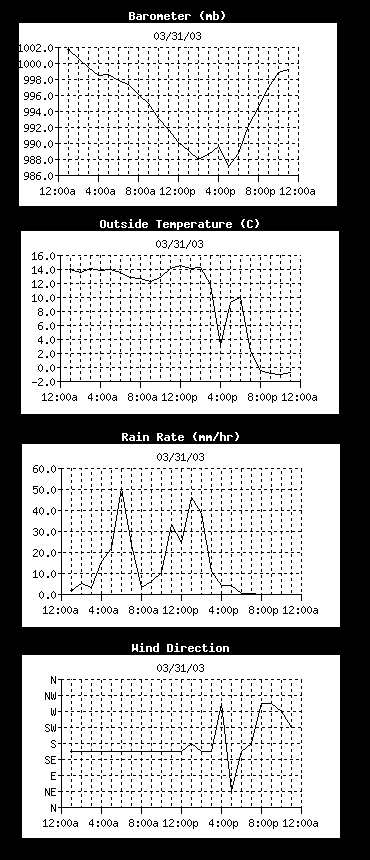
New Glasgow - time series of various elements
METARS and SAs of hardest hit areas:
Amherst Truro Caribou Pt. Saint John
Halifax Int'l Shearwater
New Glasgow - time series of various elements
| (c) NovaWeather, last edit: 05 Oct 2009 Chris Fogarty [edit Sept 28/09] |
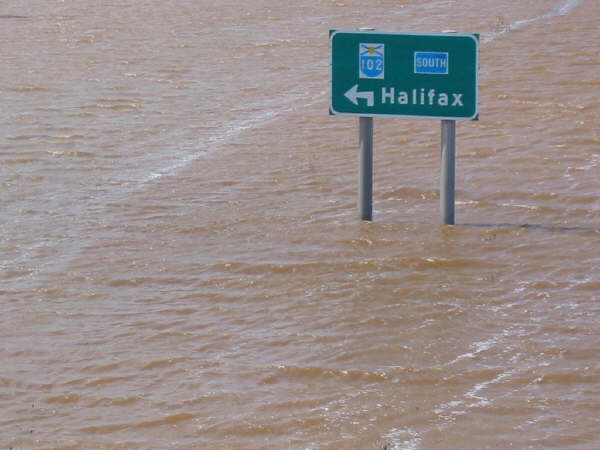
| Road sign to Halifax in a lake! (Exit 14, Truro - photo by Jerry Watson) |